
Middlesex County Neighbors by Block Source
The immediate Middlesex County block is best understood as several public record layers around one parcel. The state map identifies adjacent tax parcels. A municipal assessor supplies the tax record for a selected lot. The Registry of Deeds can explain the recorded title, plan, and easement. A local election office may have a releasable voter list, while libraries and civic organizations add historical or public community context. None of these layers is a complete household directory.
| Source | What It Shows About a Block | Access |
|---|---|---|
| MassGIS Find Abutters | Selected parcel, adjacent parcel polygons, and assessment attributes | Free desktop map |
| Municipal assessor | Tax owner, site address, mailing address, values, fiscal year, and last-sale clue | City or town portal, counter, or request |
| Registry deed and plan | Recorded parties, legal description, lot geometry, rights, and easements | Public search; older books or plan copies may be needed |
| Local voter list | Legally releasable registration fields for a requested municipality | Local election office; protected records withheld |
| Library atlas or directory | Historic structures, older households, address sequence, and neighborhood changes | Local-history collection or archive |
For a Middlesex County block check, keep the selected parcel's address, LOC_ID, municipality, fiscal year, and map extent. A separate taxable parcel may be a unit, common area, public way, railroad or utility strip rather than a nearby household. A property owner can use a different mailing address. The map is an assessor representation, while the deed registry remains the authority for legal boundaries.
Note: Record the map date and fiscal year before comparing Middlesex County parcel details with a local assessor or deed image.
Find Middlesex County Neighbors with MassGIS
The Massachusetts Interactive Property Map has a specific desktop tool for a Middlesex County abutter search. It is more reliable than estimating an adjacent lot from a street address. Use the address type-ahead, select the result, and click the parcel itself. The yellow address marker is not the same as selecting a parcel. Once the parcel is selected, the Find Abutters tool identifies the adjoining geometries.
- Select the parcel on a desktop browser and record its address, municipality, LOC_ID, and displayed fiscal year.
- Open the left menu, choose Find Abutters, then click Apply.
- Expand the triangle on each highlighted parcel popup to inspect the selected assessment information.
- Use the parcel table filtered to the current map extent when nearby lots need to be enumerated.
- Open the municipal assessor or Registry record when the popup is stale, blank, or needs legal confirmation.
The selected parcel and abutters turn yellow. The measure tools can describe a segment of the block, but they do not create a legal boundary. Find Abutters is unavailable on mobile, so a Middlesex County neighbor check that depends on the tool needs a desktop session.
The image from the official MassGIS property-map page shows the statewide parcel interface used to begin a Middlesex County block check.
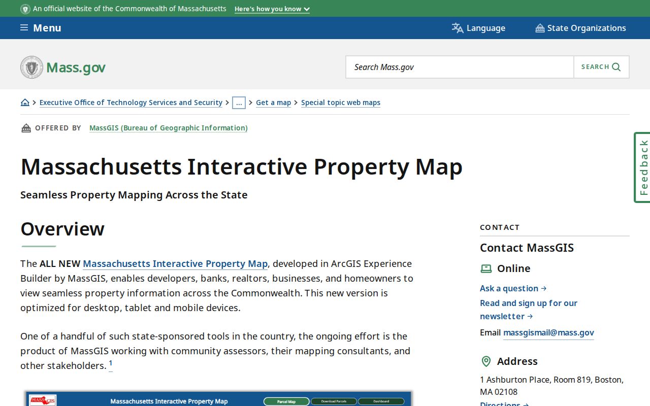
After the adjacent parcels are highlighted, each result still needs an assessor or Registry check before it is treated as current evidence.
Middlesex County Neighbors in Parcel Data
MassGIS standardized parcel data separates the site address from the tax owner's mailing address. The public schema can include owner name, owner mailing city, state and ZIP, parcel ZIP, fiscal year, last sale date and price, Registry book and page, year built, units, use code, zoning, and value fields. This separation matters for a Middlesex County block check because the tax bill can go to another municipality, state, company, estate, or trustee.
| Parcel field | Block-reading use |
|---|---|
| Site address and LOC_ID | Identifies the parcel location and its local mapping reference. |
| Owner and owner mailing address | Shows the tax record name and billing destination, not a confirmed occupant. |
| Fiscal year and assessed values | Places the assessment information in time and helps identify a stale map update. |
| Last sale and Registry book or page | Creates a bridge to the recorded land document. |
| Use code, units, and zoning | Provides land-use context without naming every person associated with the parcel. |
The parcel layer receives municipal submissions weekly and publishes reviewed batches about monthly, but municipal update timing differs and the popup's fiscal year may differ by town. The MassGIS parcel-data description explains the statewide attributes. For a current correction, tax bill, exemption, or local fiscal-year question, contact the municipality instead.
Map Middlesex County Neighbors by Parcel
Use a compact evidence trail when mapping a Middlesex County block. Begin with one property, move outward to the highlighted abutters, then decide whether a deed, voter request, permit, or historic map answers the remaining question. The flow prevents a confusing mix of tax mail, geometry, and occupant history.
Known address → selected MassGIS parcel → Find Abutters and current-extent table → municipal assessor details → Registry deed or plan → local voter request or historic community source when lawful and relevant.
For every nearby lot, record whether it is a taxable home parcel, condominium account, common area, utility strip, public way, or other assessment polygon. A registry plan can clarify an easement, lot line, or subdivision when the map appears ambiguous. For a full named-street chain rather than the immediate block, use the Middlesex County by-street directory.
Middlesex County Neighbors Through Deeds
Recorded plans and deeds explain what the parcel graphic cannot. Middlesex County is divided between North and South Registry districts, so route the town first. A deed can show grantor and grantee, recording date, book and page, legal description, prior instrument reference, plan or lot reference, and sometimes a recorded easement. Those items help distinguish legal adjacency from a parcel that merely looks close on the screen.
Start with the assessor's last-sale book and page, then open the instrument and preserve its legal description. For older records, street addresses may be absent. The North Registry's ordinary computer index starts in 1966 even though records reach back to 1629. Older work may require unindexed books, microfilm, a public terminal, or a copy request. A deed identifies recorded title, not necessarily the present household.
Note: A plan, lot reference, or easement can matter more than a modern street number when a Middlesex County block has been subdivided.
Middlesex County Neighbors and Voter Lists
A Middlesex County block cannot be pulled from a statewide reverse voter directory because Massachusetts does not publish one. The state status checker is for an individual voter and requires first name, last name, birth month, day, year, five-digit residential ZIP, and an agreement. It cannot browse a street or generate a block list.
The Secretary's voter-information guidance says local voter records are public and may include name, address, party, date of birth, active or inactive status, and voter ID. Request an annual register, street list, or defined local electronic file from the municipality. Ask about an inspection appointment, paper copy, spreadsheet, or labels, and allow the office to remove confidential registrations and Address Confidentiality Program participants. The statewide central voter file is restricted under G.L. c. 51, § 47C.
Middlesex County Neighborhood Groups, Not Rolls
Public organizations can add civic context for a Middlesex County block without creating a private roster. The documented Lowell Neighborhood Groups List is from 2019. It is a public organization inventory, not a current membership roll. Cambridge's Historical Commission research aids and Somerville preservation resources can also help identify public neighborhood history, boundaries, meeting material, and archived context.
Highlands Circle Neighborhood Group
Listed in Lowell's 2019 official neighborhood-group inventory. Confirm any current public meeting or contact route with the city before relying on it.
Highlands Neighborhood Association
Also listed in the dated Lowell inventory. The list identifies a public civic lead, not an attendance list or household directory.
Jackson Appleton Middlesex Group
Appears as a business-residents association in the 2019 Lowell list. Use public officers, notices, and meetings only.
A public association page can support a stated boundary, contact, meeting, or civic issue. It does not authorize reconstruction of a private list. The same boundary applies to congregations, clubs, block-watch groups, and similar organizations. Use publicly posted officers, newsletters, minutes, and archival material instead.
Middlesex County Neighbor Source Comparison
Official sources and commercial neighbor tools answer different questions. The official sources identify their custodian, record date, and legal limits. Commercial tools combine public records, marketing material, prior addresses, inferred relatives, and purchased data. Their results can be stale or wrong, and an opt-out must be handled separately with each provider. A Middlesex County neighbor conclusion should return to the record keeper.
| Source category | Strength | Limit |
|---|---|---|
| Official parcel, deed, and voter sources | Named custodian, stated fields, record date, and correction route | Each source proves only its own record purpose and may withhold protected information |
| Commercial neighbor tools | May combine old address and contact clues in one place | Not an authoritative custodian; data can be stale, inferred, or incomplete |
Middlesex County Neighbor Permit Clues
Permit and inspection files describe property activity, not a resident roll. Cambridge's 2026 Permit Finder combines more than 30 permit types with address search, map display, type filters, layered results, and detail views. That can place construction, inspection, or certificate activity in a block timeline. The public announcement does not state a complete historical cutoff, so use the municipal record room when older material matters.
Other Middlesex municipalities use different portals and access rules. Municipal inspectional-services counters, public-records officers, historical commissions, library atlases, and Sanborn maps can fill a gap. A permit applicant, contractor, or owner field should never be treated as an all-purpose list of people at the address.
Private Limits for Middlesex County Neighbors
Some information about a Middlesex County block stays private even when the parcels are visible. Renters and other household members may not appear in a public property record. Utility and delivery customer identity, motor-vehicle personal data, protected voter records, sealed court or adoption material, and confidential vital details are not public block evidence. A historic tax mailing address can also be stale and should not be treated as a current location.